26. September 2015

Grasleitenkopf / DE

Wer mal wieder was länger schlafen will, früher zu Hause sein muss oder jetzt an den kürzeren Tagen nicht in die Dunkelheit kommen will kann den Grasleitenkopf gehn.

Ausgewiesen mit 3,5 Stunden ist er wie ihr vermuten könnt auch schneller zu machen. Ein Rundweg, wobei mich der Abstieg teils nicht so begeistert, da dieser ein Stück über einen steilen, steinigen Feldweg von der Lenggrieser Hütte runter geht, der einfach nicht schön ist.
Der Rest dafür schon.

Anfahrt diesmal über die A8, runter bei Holzkirchen und Richtung Bad Tölz und nach Lenggries. Wichtig hier, nicht ins Zentrum fahren sondern weitest an Lenggries vorbei und beim Schild nach Hohenburg links abbiegen. Immer grad aus, nicht den ersten Parkplatz nehmen sondern so weit es geht, da sind dann mehrere Parkmöglichkeiten z.T kostenpflichtig.

Tourenbeschreibung findet ihr auch wieder auf Höhenrausch. Es ist was komisch über den Hof von Hausnummer 5 zu gehn va. wenn man vom Balkon beäugt wird, aber das passt schon so. Das Schöne, den Weg geht wirklich kaum jemand, alle rennen gerad aus (von dort kommt ihr zurück).
 
Aussicht vom Grasleitenstein

Viel gibt's nicht zu sagen, schöne Aussicht u.a. auf Brauneck am Gipfelkreuz des Grasleitensteins

Wenn ihr von hier weitergeht müsst ihr etwas später den Abzweig links den Berg hoch nehmen um noch auf den Grasleitenkopf zu nehmen, geradaus geht's direkt zur Hütte. Hier habt ihr Eure 750hm geschafft.

Seekarkreuz vom Grasleitenkopf
Gegenüber seht ihr das Seekarkreuz - ihr könnt die Tour darüber noch verlängern.


Vom Grasleitenkopf müsst ihr nur ein Stück absteigen um an der Lenggrieser Hütte anzukommen.
An dem sonnigen Tag im Mai ging's entsprechend zu und da meine Erinnerung über die zumindest letztes Jahr nicht allzu freundlichen Hüttenwirte und die verkümmelte Speckknödelsuppe mir die Lust anzustehn nicht steigerte, bin ich abgestiegen. 
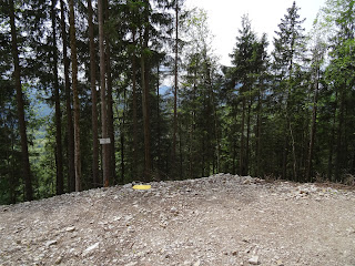
Der schöne "Feld"weg
Erstmal einen schönen Pfad/Steig durch den Wald, dann den Feldweg und hier an entsprechender Stelle rechts Richtung Lenggries abzweigen. 

 
Schee war's. 

20. September 2015

Kofel / DE

Wer keine Lust hat früh aufzustehn, der kann sich den Kofel für eine Tour vornehmen. Die Tour ist mit insgesamt 3,5 Stunden angesetzt und es sind auch nur 560hm.
 
Ihr fahrt die A95 Richtung Garmisch und dann nach Oberammergau. Hier auch parken, am besten am Fluß, da ist ein öffentlicher Parkplatz und der Start der Wanderung ist auf der anderen Seite der Brücke. 

Schattig in Serpentinen bergauf
Soweit ich mich erinnere ist die Tour auch gut für einen sonnigen Sommertag, da sie die meiste Zeit schattig durch den Wald geht. Nur das letzte Stück zum Gipfel ist dann in der Sonne, drahtseil-
gesichert die Felsen hoch und oben angekommen mit einem schönen Blick auf Oberammergau.

Der letzte Abschnitt zum Gipfel
Als 


 Rundweg geht's dann wieder durch Wald zurück nach Oberammergau.
Das war im Mai
 

Christchurch / NZ

My last stop of 3,5 weeks traveling the South Island was Christchurch. I already had heard from friends that you still see the impact of the earthquake in 2010 and 2011, but I wouldn't have imagined that still kind of the whole center is a red zone. There are just a few buildings in use, most are sealed off by fences because they are not save to enter or there is an empty space because the building is pulled down and nothing new yet builed. 

I would recommend to first visit Quake City. It's opposite the Container Mall and gives you a good idea about what happened. Especially the interviews are very emotional. 

The Container Mall was set-up after the earthquake because all buildings were too dangerous to enter anymore and it was the alternative for the shops. What I am informed about they are going to keep them, it looks fab.

Friends recommended to take a bus tour through the red zone, which I didn't do, but maybe an idea to do. 
 
Don't enter
Re:Start - Container Mall

Being in New Zealand I really wanted to learn something about the culture of the Maori. No idea why, but up to Christchurch I never had the chance to get into a museum or to any other place to get informed. Though last chance and I had booked a tour at Willowbank. It's a native zoo you can visit first, it's nice. Then they did a guided tour and explained a lot about the native animals and when you are lucky you can see some of the kiwis in the dark. This tour was very interesting. Afterwards they do a performance, which was not worth the money. Very short and just very touristy. At the end we had a dinner, which tasted very good. 
All in all I guess I was very lucky as we were just a group of six, if you have bad luck you are sitting there with a whole bus group.
I wouldn't recommend to pay that money for it and would look for a different option to get an idea about the Maoris.
Not sure if they are native, but it looks funny :-)

Can you see it?
Maori dance
 New Zealand was just great. I am hopefully coming back :-) !

17. September 2015

Arthur's Pass and Bealey Spur Track / NZ

I got it recommended to take the Arthur's Pass to get from the West to the East Coast and I am happy I arranged my trip accordingly to take this road.

Lake Poerua
Heading South from Punakaiki I took the route South and headed on in Greymouth on route 7 to the West. Shortly after Dobson I again headed South on a smaller road. 
First you will pass Lake Brunner and then Lake Poerua. It just started drizzling and the sky was cloudy which made the scenery very mystic and beautiful, though I had to take a short break. 

At the end of the road turn to the East to Arthur's Pass
I stopped at the Viaduct Lookout. It was cloudy when I was there, which resulted in a very limited view, but up there are many Keas, which made the stop worth it. 
Take care for your car as they love to take everything possible apart and they get beneath your car, don't kill them.
curious Kea
Kea on its way to explore my car
Yeees, there are some wipers to take apart :-)
From the lookout it's not far to get to the village Arthur's Pass itself with an ISite. You either can buy the brochure about all Arthur's Pass activities for 2NZD or download it here

Devils Punchbowl Falls
For the rest of the day I decided to go for a walk to the Devils Punchbowl Falls. It's just 1km and they look nice.


Arthur's Pass
I had enough time left though went on walking the Arthur's Pass Walking Track (3,4km). It goes through the forest more or less alongside the road. I extended the walk with the Dobson Nature Walk (750m) and finaly went on to the Misery lakes (1km), which leads you through some swampy area. You have to go the same way back.
My subjective impression, I found it a bit boring and wouldn't do it again. If you are looking for an easy walk without any up and down, it's the right walk for you. 
Chances of rain are very high on Arthur's Pass, bring a rain coat. I needed it. 

View to Arthur's Pass Village
Arthur's Pass Walk
View from the walk to the road
I stayed in the village at Avalanche Creek Shelter Campsite. It's very basic, a hut, a toilet, next to the road and train (not much traffic during the night), more or less a parking space. Really only a place to stay if you plan to do some more activities around Arthur's Pass. 

My plan had been to hike the Avalanche Peak Track starting in the village. I was warned not to go with cloudy weather 1st that you do not get lost and 2nd you won't see anything. Due to the rain the next day, I didn't go.
 
Just after the Pass, the weather cleares off

View from Bealey Spur Track
Getting further West from the Pass the weather gets better. There is a fantastic alternative. I went up the Bealey Spur Track (don't mix it up with Bealey Valley Track).  It's just an amazing hike with fantastic views of the Waimakariri River valley, I definitely would do it again! It has been pretty windy and bit rainy, bring warm clothes (I went in February = summer). This 6km hike described in the brochure ends at the Bealey hut (have a look inside. I thought it's a showroom of the past, but no it's still in use!). If the weather is ok, you have to go on to the top, it's so great.
Also with this hike you have to return on the same route you walked up.
Great, great, great!


Being a little bit sentimental...
They are real even they look self-made

Bealey Spur Hut - keep on going to the top in front of you
No showroom from the past, still in use


I loved that one ;-) "These mice arnt here to take part. There here to take over!!!"
 
On the top


Back at the car I continued my way to my last stop Christchurch. The great nature continued on this way.


13. September 2015

Punakaiki / NZ

Coming from Abel Tasman I took the Motueka Valley Highway, Route 6 (direction Westport) and down south the West Coast to Punakaiki. That's quite a way of 320km, at least you are always surrounded by great nature. 

Punakaiki Beach Camp
I arrived in the late afternoon and stayed at Punakaiki Beach Camp. Check before for the tides as it's only of interest to be here at high tide. 
Walk from the camp up to the blowholes
You can walk from the Camp up the hill to the Pancake Rocks and Blowholes.

Pancake Rocks

Blowhole

Pretending to be a princess on the throne ;-)
Pancake Rocks
The Cavern - it's dark, don't forget the torch
On your way back go into The Cavern, when it's dark. Take a torch to find your way, especially your way out ;-)
Switch off the light when you are in and you can see glowworms :-)


Truman Track
The next morning I went north a little bit again, just before Punakaiki and walked the Truman Track. A short 15 min track taking you down to the beach. When I arrived it was high tide and the strength of the sea is just scary. 
A couple told me if you cross the beach you can walk on, but no idea.

Truman Track
Generally, the drive along the coast is spectacular itself.